
Choose your coast and base
Koh Lanta beaches compared and where to stay
Stay on Khlong Dao or Phra Ae (Long Beach) for long sandy beaches near Saladan pier and the most places to eat. Choose Khlong Nin for gentle family swimming, Khlong Khong for sunsets and beach bars, and Kantiang Bay for a quiet 1 km southern bay with snorkelling, about 20 km from the pier.
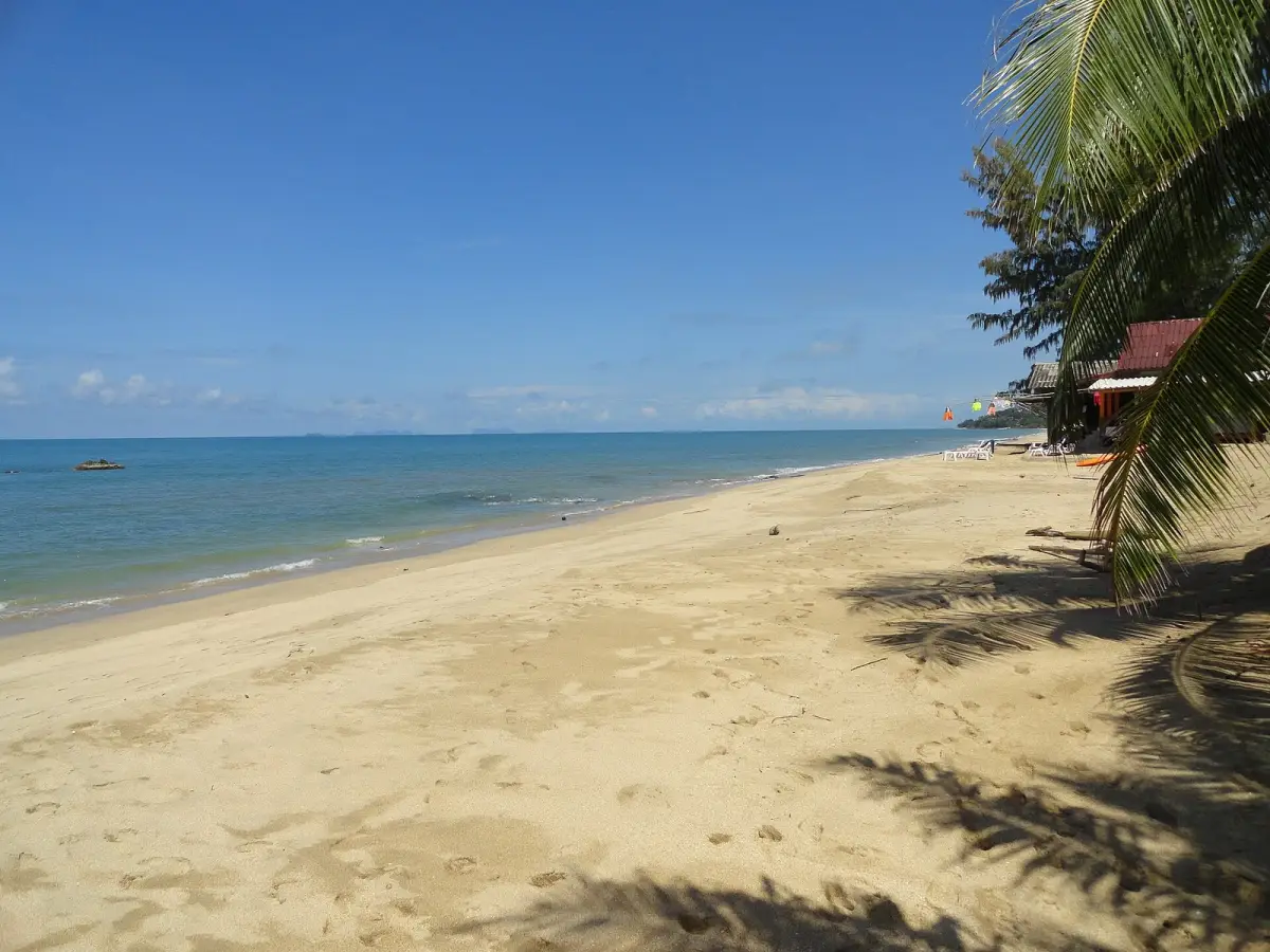
Klong Nin Beach in October 2023. Sea conditions and the exposed beach change with weather and tide.
Photo: Fabio Achilli / Wikimedia Commons · CC BY 2.0 · resized and converted to WebP · Klong Nin Beach, Koh Lanta

Pick the beach first, then the room. The beach decides how you swim, what you see at low tide and how lively your evenings are; the room decides how far you walk to breakfast and dinner. This guide compares the beaches down Koh Lanta Yai’s west coast and the bases they make. The separate central-coast guide looks at three neighbouring beaches in more detail.
Koh Lanta beaches and where to stay at a glance
Koh Lanta’s holiday beaches line the west coast of Koh Lanta Yai, from Saladan pier in the north to the national park at the southern tip. TAT’s Krabi brochure lists Kho Kwang, Khlong Dao, Phra Ae, Khlong Khong, Khlong Nin and Ba Kan Tiang (Kantiang) as beaches reached by road. All of them face the open Andaman Sea to the west, so every beach here has a sea sunset.
| Beach, north to south | What it is like | Swimming and low tide | Stay here for |
|---|---|---|---|
| Khlong Dao (Klong Dao) | About 3 km of light, fine sand; quiet | Gentle slope; sea retreats 100–150 m | Short trips to Saladan pier |
| Phra Ae (Long Beach) | Longest beach, 3–4 km; cafés and bars nearby | Still swimmable at low tide | The most places to eat |
| Khlong Khong (Klong Khong) | Rocky reef offshore; beach bars, live music | Stony entry; best near high tide | Sunsets and relaxed evenings |
| Khlong Toab (Klong Toab) | Quiet; little sand along one half | Wide rocky flats | A calm central base |
| Khlong Nin (Klong Nin) | White, fine sand; beach cafés | Gradual entry, best at the north end | Families and easy beach days |
| Kantiang Bay | About 1 km curving bay; fine sand, uncrowded | Corals for snorkelling | A quiet southern stay |
| Khlong Chak and Bamboo Bay | Short, semi-wild southern bays | Khlong Chak swimmable in its centre | Seclusion over convenience |
The descriptions come from Wikivoyage and Thailand Beaches surveys published between October 2024 and June 2026, read on 22 October 2026. They describe typical conditions, not a particular day: tide, season and erosion change every one of these shores. Kho Kwang, a curved bay at the far north near Saladan, has lovely sand on Wikivoyage’s account, but Thailand Beaches calls it practically unsuitable for swimming.
Use these Khlong Dao map results, Phra Ae map results and Kantiang Bay map results to see where each beach sits beside your hotel’s own pin.
Why Phra Ae and Long Beach deserve a closer look
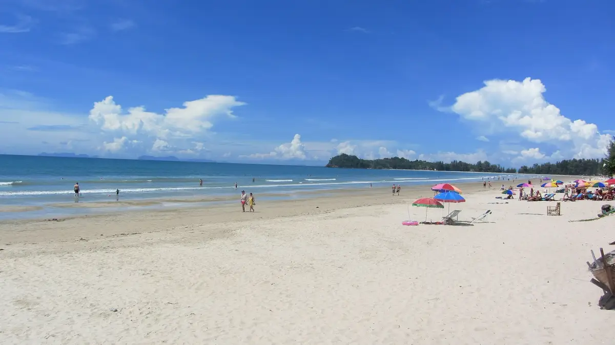
Phra Ae and Long Beach are two names for the same beach, and it is the island’s longest: about 3 km in Thailand Beaches’ August 2025 survey, about 4 km on Wikivoyage. Layana’s beach page describes a west-facing sandy shore fringed with tall trees. Thailand Beaches found the beach still swimmable at low tide, when the water pulls back only about 10 metres, and called it ideal for families and snorkellers. It also notes stones at one end and advises against swimming near the river mouth.
The main road behind the beach has cafés, bars and massage places, so Long Beach gives you the widest choice of meals within walking distance. The trade-off is length: a room at one end can be a long walk from the other, so pick the stretch that puts your favourite cafés close. Phra Ae Beach Public Park, named as a July 2025 event venue on Thailand’s government portal, is a useful landmark on the map.
Northern convenience or a southern bay
Choose the north for short trips to the pier, shops and boat departures; choose the south for quieter bays and the national park on your doorstep. On OSRM routing run on 22 October 2026, Saladan pier is about 2.5 km from Khlong Dao and about 5.5 km from the middle of Long Beach, both under 10 minutes by car.
Khlong Dao is a crescent of about 2.7 km of light sand in Thailand Beaches’ survey, with a gentle slope and few tourists compared with Long Beach. Thai families come for picnics. Its catch is the tide: at low water the sea retreats 100 to 150 metres, so swimming is a high-tide activity here.
Kantiang Bay is the southern favourite. Wikivoyage describes a beach about 1 km long on a gently curving shoreline, uncrowded even in the busy holidays, with good corals for snorkelling; Thailand Beaches adds fine sand and a peaceful mood. Kantiang is about 20 km, roughly 35 minutes, from Saladan pier and about 6 km from the national park at Laem Tanod. Beyond it, Khlong Chak is a short bay of about 1 km, swimmable in its centre, and Bamboo Bay is the island’s southernmost beach, semi-wild and uncrowded. See Khlong Chak map results and Bamboo Bay map results.
A southern base works well with a few planned rides north. If you would rather explore the island on your own schedule, renting a car or a scooter on Koh Lanta lets you reach every beach in this guide at your own pace.
The central beaches and the east coast
Stay in the middle of the west coast if your plans point in both directions. Khlong Khong, Khlong Toab and Khlong Nin sit within about 5 km of each other. Wikivoyage describes a rocky reef along Khlong Khong that makes swimming difficult but suits sunsets, and white, fine sand at Khlong Nin, with the northern stretch best for swimming. Thailand Beaches calls Khlong Nin a kiddie-pool beach for children. Khlong Toab is the quiet one, with little sand along one half in its October 2024 survey. The Khlong Toab, Khlong Nin and Khlong Khong comparison covers tides, evenings and distances in detail.
Lanta Old Town on the east coast is a village base, not a beach: its wooden houses stand over the water. Old Town is about 10 km by road from Khlong Nin, so an east-coast room still puts the west-coast sand within a short ride.
Koh Lanta Noi, across the bridge to the north, has village addresses rather than holiday beaches. Booking platforms sometimes describe the whole district as Koh Lanta, so the property pin is the reliable guide.
Families, walking routes and beach access
For families, the shortest daily walks matter more than the prettiest bay. Khlong Nin and Long Beach are the easiest swimming beaches in the surveys above, and Khlong Dao suits paddling at high tide. Shade, a pool for rough-sea days and a short route to dinner make the biggest difference on a family holiday.
Beachfront does not always mean step-free. Sand is hard work for pushchairs and some mobility aids, and a short path can include steps. A current photograph of the route from room to sand settles the question quickly.
Nearby does not always mean walkable either. The FCDO highlights Thailand’s road accident risk, particularly for motorcyclists, and the coast road often has no pavement. You do not need to ride to enjoy the island: the guide to Koh Lanta without a scooter explains the alternatives, and our island taxis cover hotel moves and rides between beaches.
Tides and season change the beach you booked
The same beach looks different at high and low tide. Khlong Dao loses 100 to 150 metres of water at low tide, Khlong Khong and Khlong Toab expose rocks, and Long Beach stays swimmable. A tide table for your dates shows when each beach is at its best.
The FCDO advises particular care in the monsoon, generally May to October, warns of strong riptides and says to follow local signs and red flags. Calm-looking shallows are not a safety assessment, so supervise children closely and stay out when swimming is prohibited.
Use marked access, take rubbish away and follow beach notices. TAT’s 2017 announcement included Phra Ae and Khlong Dao in Thailand’s beach smoking ban, so smokers use designated areas.
What to send before you book your room
Send the hotel three questions before paying: which beach entrance do we use, where can we eat on foot, and is the route lit and step-free? Add your children’s ages or any mobility needs.
To see several beaches before choosing, a Koh Lanta sightseeing outing takes you down the west coast by car or tuk-tuk. For arrival, send us your hotel pin, date, group size, luggage and arrival point for a transfer quote, and we will reply with the options and the price.
Quick answers
Frequently asked questions
Are Phra Ae Beach and Long Beach the same place?
Yes. Phra Ae, also written Phra-Ae or Pra Ae, is the beach commonly called Long Beach on Koh Lanta. It lies just south of Khlong Dao and is the island’s longest beach, about 3 to 4 km. Hotels use either name, so search for both when comparing rooms.
Is Long Beach a good base without renting a scooter?
Yes, if your room is near the sand and the cafés, bars and shops along the main road. Long Beach is 3 to 4 km long, so the far end can be a long walk away. A taxi or tuk-tuk covers the longer trips, and Saladan pier is about 5.5 km by road.
Which Koh Lanta beach should a family choose?
Khlong Nin is the usual family choice, with fine sand and a gradual entry that is best on its northern stretch. Long Beach stays swimmable at low tide, while Khlong Dao’s gentle slope suits paddling but the sea retreats 100 to 150 metres at low tide. Red flags mean no swimming on any of them.
Is Kantiang Bay too far south for a first visit?
No. Kantiang is a curving bay about 1 km long with fine sand, an uncrowded feel and corals for snorkelling. It is about 20 km, roughly 35 minutes by road, from Saladan pier and about 6 km from the national park. It suits a quieter stay with a few planned rides north.
Can you walk from one Koh Lanta beach to the next?
Only along the same beach. Headlands, streams and rocky sections separate the bays, and the coast road between them often has no pavement. For another beach, a short taxi or tuk-tuk ride is the easy option, especially after dark.
Is Lanta Old Town a beach destination?
No. Lanta Old Town is an east-coast village with wooden houses over the water and no sandy beach. Stay there for the village setting, or visit it from the west coast: it is about 13 km by road from Long Beach and about 10 km from Khlong Nin.
Can you swim at Koh Lanta beaches during the rainy season?
Sometimes, depending on local conditions and swimming warnings. Calm-looking water does not guarantee safe swimming, and red flags mean no swimming. The FCDO warns of strong riptides, especially during the monsoon, generally May to October, and says to follow warning signs and red flags. A hotel pool or a beach walk makes a good plan for rough-sea days.
Do you need a beachfront hotel on Koh Lanta?
No. A room a short walk from a public beach entrance works well on every beach in this guide. What matters is the actual route to the sand, because a short straight line on a booking map can hide a road crossing, steps or a slope.
Sources and further reading
Last full fact check: 22 October 2026. Fees, hours and schedules change, so confirm anything time-sensitive before you travel.
- Tourism Authority of Thailand: Krabi brochure, Koh Lanta beaches and road access (undated)
- Wikivoyage: Ko Lanta travel guide, beach descriptions (read 22 October 2026)
- Thailand Beaches: guide to Koh Lanta beaches (31 October 2024, updated 12 June 2026)
- Thailand Beaches: Klong Dao Beach, Koh Lanta (29 October 2024, updated 27 August 2025)
- Thailand Beaches: Long Beach, Koh Lanta (29 October 2024, updated 27 August 2025)
- Thailand Beaches: Klong Toab Beach, Koh Lanta (October 2024, updated August 2025)
- Layana Resort: Phra Ae or Long Beach, beach landscape and west-facing position (read 21 October 2026)
- THAILAND.GO.TH: Phra Ae Beach Public Park event location (30 June 2025)
- OpenStreetMap: Koh Lanta coast, settlements and road layout (read 22 October 2026)
- Project OSRM and OpenStreetMap: road routing used for distances and drive times (22 October 2026)
- GOV.UK (FCDO): Thailand swimming and road safety advice (read 21 October 2026)
- Tourism Authority of Thailand: smoking ban including Phra Ae and Khlong Dao (16 October 2017)
Photo credits
- Photo: Vaclav Zrno / Wikimedia Commons · CC BY 3.0 · resized and converted to WebP · Lanta Island resort - panoramio

Arrange it with us
Services for this part of your trip
Taxi & tuk-tuk
Private cars, pickup taxis and tuk-tuks, anywhere on Koh Lanta.Sightseeing tours
Sightseeing around Koh Lanta: beaches, Lanta Old Town and the National Park.Airport & regional transfers
Private transfers throughout Koh Lanta, Krabi and Phuket, including airports, hotels and piers.Car rental
Various models for road trips around Koh Lanta.
Keep planning
More Koh Lanta guides
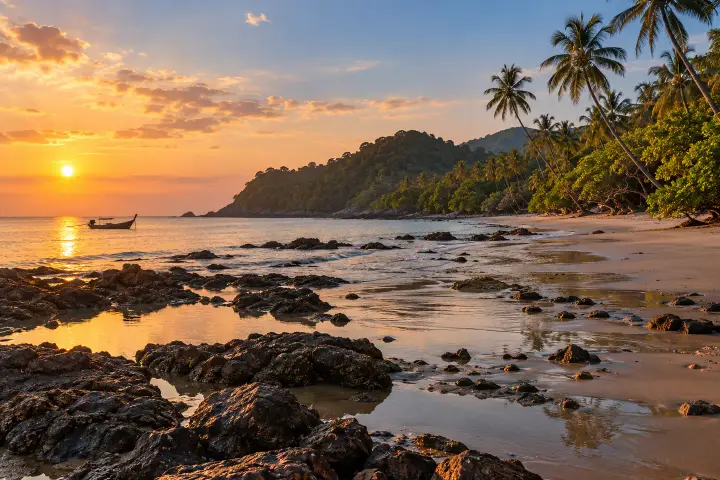 Life on Koh Lanta Khlong Toab, Khlong Nin or Khlong Khong for your stay? Klong Nin vs Klong Khong vs Klong Toab on Koh Lanta: sand, rocks at low tide, evenings, distances and who each beach suits, checked October 2026.
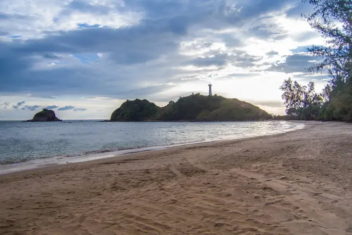 Planning your stay Things to do in Koh Lanta with a three-day itinerary Plan three days on Koh Lanta with beaches, the national park, one boat day, mangroves and Old Town, plus practical family, rain and non-rider alternatives.
 Getting to Koh Lanta How to get to Koh Lanta and choose your arrival route How to get to Koh Lanta from Krabi Airport, Ao Nang, Krabi Town, Phuket or Trang: road transfer with the car ferry or speedboat to Saladan, with times.
Photo: Lanta Adam Tour (supplied photograph)

Questions about your trip?
Ask a local family on Koh Lanta
Tell us your dates and plans on WhatsApp. We’ll reply with options, the price and what’s available.
Or plan your trip in one message